CHARLOTTE
— After several days of unrelenting storms, much of
central and western North Carolina
is finally beginning to dry out — but only temporarily. The week’s heavy rainfall triggered
flash flooding
, elevated river levels, and issued warnings for more severe weather to come.
Local emergency management teams are keeping a close eye on water levels as saturated ground and full waterways heighten the risk for further incidents heading into the weekend.
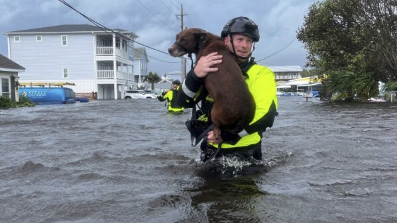
Flash Flooding Impacts Lincolnton, Greensboro, Chapel Hill
Late Wednesday night,
flash floods inundated Lincolnton
, leading to road closures and emergency responses. Earlier in the week, similar conditions disrupted life in
Greensboro and Chapel Hill
, reinforcing the widespread reach of the storm system.
According to data from the
U.S. Geological Survey
, several locations recorded
two-day rainfall totals exceeding 2 inches
, with some exceeding 3 inches.
“It was like a tropical downpour without the hurricane,” said one resident near Lincolnton. “You just don’t expect this kind of rainfall midweek.”
Top Rainfall Totals Across the State
As of Thursday morning, the
Pinpoint Weather Alert Day
remains in effect, with officials tracking the following
48-hour rainfall totals
:
-
Yadkin River at Yadkin College
– 3.12 inches
The
highest total recorded
, raising concerns about downstream flooding risk. -
Yadkin River at Patterson
– 2.24 inches
Rainfall in the
foothills
led to elevated river conditions, but it fell steadily, reducing flash risk. -
Charlotte – Fire Station 27
– 2.10 inches
Parts of Charlotte experienced
minor flooding and slick road conditions
, particularly in low-lying areas. -
Killian Creek near Mariposa
– 1.86 inches
Impacted
Western Mecklenburg and Lincoln counties
, contributing to flooding in Lincolnton.
“These rain totals, while not record-breaking, fell quickly and overwhelmed drainage systems,” meteorologist
Ted Phaeton
noted in a
QC News
report.
More Severe Weather in the Forecast
The National Weather Service warns that North Carolina remains under a
Marginal Risk for Severe Weather
heading into the weekend. Thursday afternoon could bring
damaging winds and isolated flooding
, particularly in the Charlotte area.
Storms are expected to
develop after 3 p.m.
and linger through dinnertime, with
overnight lows in the low 70s
and daytime highs hitting the
low 90s
through the weekend.
Ciara Lankford
reports that pop-up storms will likely continue, especially during
peak heating hours
, through at least the
middle of next week
.
What to Expect This Weekend and Beyond
-
Friday:
Highs in the low 90s, afternoon storms possible -
Saturday–Sunday:
Pop-up thunderstorms, highs in the
mid-90s
-
Monday:
Continued chance of showers -
Midweek:
Slight cooldown, but
active storm pattern persists
Stay Alert, Stay Prepared
Residents in affected areas are urged to monitor updates from the
National Weather Service
, heed
flood warnings
, and avoid low-lying roadways during heavy downpours.
Have you experienced flooding or damage from the recent storms? Share your story with us in the comments at SaludaStandard-Sentinel.com.