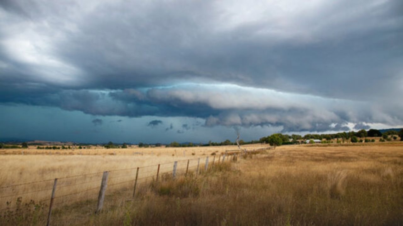
OMAHA, NER As a cold front moves over the state, residents in eastern Nebraska are being warned to brace for strong to severe thunderstorms on Friday night. Forecasters caution that the system may bring hail that is about an inch in diameter, dangerous wind gusts of up to 70 mph, and heavy rains that might cause localized flooding.
What to Expect Friday Evening
According to the Omaha/Valley office of the National Weather Service, storms are most likely to form late Friday afternoon and last into the night. Although there is little chance of a tornado overall, the combination of strong winds, hail, and areas of heavy rain presents a serious risk to public safety and property.
According to meteorologists, some of these storms will be able to produce widespread wind gusts of 60 to 70 mph, which can easily bring down trees and power lines. They also advised drivers to be ready for limited visibility and ponding on roads in the areas that are most affected.
Areas Most at Risk
The communities that would be most affected are those that extend from Norfolk to Lincoln and into Omaha. As lightning, strong gusts, and hail threaten to disrupt or cancel Friday night’s outdoor events, such as high school football games, community festivals, and concerts.
Residents are being reminded by emergency managers to have several means to get severe weather notifications and to keep their mobile devices charged, especially after dark when it may be more difficult to notice warnings.
Flooding Concerns and Safety Steps
Localized floods, in addition to wind and hail, can occur when storms pass over the same locations frequently. Reports of clogged storm drains or rising water on low-lying roads are being monitored by both rural counties and city crews.
Safety authorities advise:
- Avoiding flooded roadways, even shallow water.
- Moving outdoor furniture, grills, and other unsecured items indoors.
- Preparing a backup light source in case of power outages.
Cold Front Brings Weekend Relief
The good news for Nebraskans is that this terrible weather will pass quickly. By Saturday morning, the state will experience considerably colder air due to the cold front that caused Friday’s storms. After a tumultuous close to the workweek, the weekend’s highs are predicted to settle into the low to mid-70s, with largely sunny skies and drier weather.
Forecasters warn, though, that if Friday’s storms intensify more than anticipated, more advisories might be issued.
With destructive gusts, large hail, and flash flooding possible, Friday evening’s storms pose the most severe weather threat to eastern Nebraska in weeks. Residents of the Omaha metro area and the surrounding areas are urged to stay vigilant about the weather, modify their outdoor plans, and act quickly in the event of a warning.
Given the possibility of a storm, will you be changing your plans for Friday night? Post your preparations in the comments section below.


