Boston, Massachusetts.As a building tropical storm generates seas rising over thirty feet and winds approaching gale-to-storm intensity, dangerous conditions are moving across the Atlantic waters around New England and the Mid-Atlantic. All seafarers are advised to stay in port until the end of the week due to the extension of tropical storm warnings throughout important offshore zones by the National Weather Service’s Ocean Prediction Center.
Warnings in Effect
With warnings extending from Long Island waters south to Cape Fear, North Carolina, the storm’s reach encompasses large swaths of the U.S. Eastern Seaboard. The Hudson Canyon, Georges Bank, and offshore waters close to Cape Hatteras are among the specific marine areas that are under advisory.
-
Winds:
Forecast to peak between
40 and 55 knots
(46 63 mph). -
Seas:
Building to
20 37 feet
in open waters, with localized crests surpassing
30 feet
.
Offshore North Carolina is predicted to see the largest waves, with seas reaching over 36 feet by Thursday evening. While the waters near Long Island are expected to reach 25 feet, mariners east of Cape Cod and south of George’s Bank may encounter swells of up to 29 feet.
Impact on Coastal and Offshore Communities
Major shipping and fishing channels are impacted by the storm’s extensive footprint, which extends hundreds of miles. Urgent warnings have been issued for both commercial fleets and recreational boaters by U.S. Coast Guard units and local port authorities:
Officials recommended staying docked until the seas subsided, noting the severe risk of capsizing, equipment damage, and potentially fatal circumstances offshore.
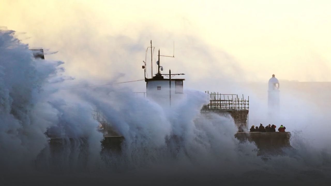
Ripples are being felt onshore even though the storm’s center is still offshore. Despite generally quiet beach conditions, swimmers and surfers are at risk due to severe rip currents that are present throughout the Outer Banks of North Carolina and portions of the New England coastline.
Timeline of the Storm
-
Thursday Afternoon:
Winds strengthen across offshore waters; seas rise rapidly. -
Thursday Night Friday:
Peak storm impact, with widespread 30+ foot seas and winds topping 50 knots. -
Saturday into Monday:
Gradual improvement, though
large swells will persist
, keeping conditions risky for smaller vessels.
If the storm moves farther north before clearing, more advisories could be issued, according to forecasters.
Historical Context
During the late summer hurricane season, tropical systems that create 30-foot seas in the North Atlantic are not unusual; yet, they are still exceptional and pose a significant risk to maritime operations. The storm is one of the more dangerous offshore events of 2025 because of its extensive coverage of both New England and Mid-Atlantic waterways.
Particularly at risk are fishing activities in Hudson Canyon and Georges Bank. Over the weekend, delayed departures and messed-up shipping schedules are anticipated, highlighting the ongoing effects of offshore storms on the local economy.
Safety Guidance
Several important safety precautions are being reinforced by authorities:
-
Do not attempt offshore travel
until conditions improve late Saturday. -
Check port updates
frequently, as many harbors remain on storm footing. -
Avoid swimming and surfing
in affected areas due to
life-threatening rip currents
. -
Recreational boaters
should double-check moorings and keep vessels secured.
Looking Ahead
Although maritime forecasts caution that persistent swells may persist into early next week, conditions are expected to gradually improve starting on Saturday. Although there is little chance of tornadoes or inland floods right now, the storm serves as a reminder of how erratic Atlantic tropical activity can be as hurricane season draws to a close.
Are you getting ready for this tropical storm in New England or along the Mid-Atlantic coast? Post your experiences and updates in the SaludaStandard-Sentinel.com comments section.


