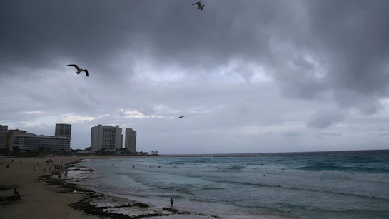
RALEIGH, NCHurricane Erin is tearing toward the East Coast, causing the Carolinas and portions of Georgia to issue a flurry of travel advisories, beach closures, and emergency declarations. Officials in North Carolina and Virginia are warning of severe surf, flooding, and beach erosion as the Category 1 hurricane churns offshore, and many barrier island communities are undergoing mandatory evacuations.
NC Declares State of Emergency, Orders Evacuations
As Hurricane Erin drives huge waves and powerful winds into the Outer Banks, Governor Roy Cooper declared a state of emergency. Authorities have mandated evacuations for:
-
Ocracoke Island
-
Dare County s Hatteras Island
-
Hyde County coastal communities
High surf is predicted to overwash NC Highway 12, the only road to some areas of the Outer Banks, the NC Department of Transportation has warned. Traffic jams on the mainland and limited ferry connections are complicating evacuation efforts.
Beaches Close, Tourists Urged to Leave
Beaches from Emerald Isle to Nags Head have been closed for safety, and visitors are being warned to avoid the area along the North Carolina coast. Officials are keeping a careful eye on the tides, and many coastal municipalities have issued voluntary evacuation advisories.
National Weather Service issued a warning about:
-
Rip currents
-
6 10 foot wave swells
-
Beach erosion
-
Localized flooding
in low-lying areas
Although officials are advising residents to first look for lodging with friends or relatives inland, shelters have opened in Carteret, Dare, and Currituck counties.
Storm Alerts Extend Into Virginia
Coastal areas in Virginia from Virginia Beachdown to the Chesapeake Bay region have received similar alerts. Beach closures and surf advisories are in effect, and people have been warned to keep an eye on updates and stock emergency kits, even though no mandatory evacuations were mandated.
Georgia Coastal Counties Now in Watch Zone
Coastal counties including Chatham, Glynn, and Camden are currently under a tropical storm watch, despite the fact that Hurricane Erin is not predicted to reach Georgia. Beginning late Tuesday and continuing into Wednesday, the National Hurricane Center forecasts rain squalls, gusty winds, and mild flooding along the Georgia coast.
Sandbags are being prepared and storm drains are being cleared by officials in Savannah and Tybee Island. Because of the possibility of coastal road closures, visitors to beach villages have been encouraged to change their plans or depart early.
Airports, Travel Plans Disrupted
As the storm approaches, some cancellations are anticipated and delays are being experienced by flights into Wilmington (ILM) and Norfolk International Airport. It has been suggested that passengers using the airports in Charlotte, Raleigh, and Atlanta check with their airlines for the most recent information.
Hurricane Erin s Latest Forecast and Track
Hurricane Erin is predicted to continue a Category 1 storm, primarily offshore but still causing major damage along the Atlantic coast, according to the National Hurricane Center (NHC) and NOAA.
-
Projected Track
: Parallel to the southeastern coastline, from South Carolina through the Mid-Atlantic -
Peak Impact
: Tuesday night through Thursday morning -
Threats
: Beach erosion, minor flooding, strong currents, 30 50 mph wind gusts near shorelines
Meteorologists stress that coastal hazards are still very serious even in the absence of direct landing.
Community Resources and Emergency Contacts
In the impacted locations, locals are urged to:
- Follow local emergency management pages
-
Sign up for
weather alert systems
-
Prepare
3-day emergency kits
(water, food, flashlights, medication) -
Know your
evacuation routes
Go to ReadyNC.gov for resources in North Carolina. See GeorgiaEmergencyInfo.com for Georgia.
Keep yourself informed and protected. This week, have you have to evacuate or get ready for Hurricane Erin? Leave a comment at SaludaStandard-Sentinel.com with your tale or advice.


