North Carolina’s RaleighAuthorities are warning of major erosion, hazardous surf, and flooding in several areas of the Outer Banks as Hurricane Erin approaches the North Carolina coast. In preparation for the storm’s landfall, a state of emergency has been proclaimed, and mandatory evacuations have already been issued for Hatteras Island, Ocracoke Island, and Dare County.
Evacuations Ordered Across Key Coastal Areas
For a number of high-risk barrier islands, state and local disaster management officials issued mandatory evacuation orders starting on Saturday:
-
Ocracoke Island (Hyde County)
: All visitors were told to evacuate by 12 p.m. Saturday, and residents by 9 a.m. Sunday. -
Dare County
: Visitors to Hatteras Island were required to leave by 10 a.m. Sunday. -
Hatteras Island
: Expected to bear the brunt of coastal flooding, surf damage, and road washouts.
In order to facilitate prompt access to response resources and federal assistance in the event that it becomes necessary, Governor Roy Cooper issued the executive order declaring a state of emergency. Cooper urged both locals and visitors to avoid taking any chances. These barrier islands are particularly susceptible to erosion and storm surge brought on by hurricanes.
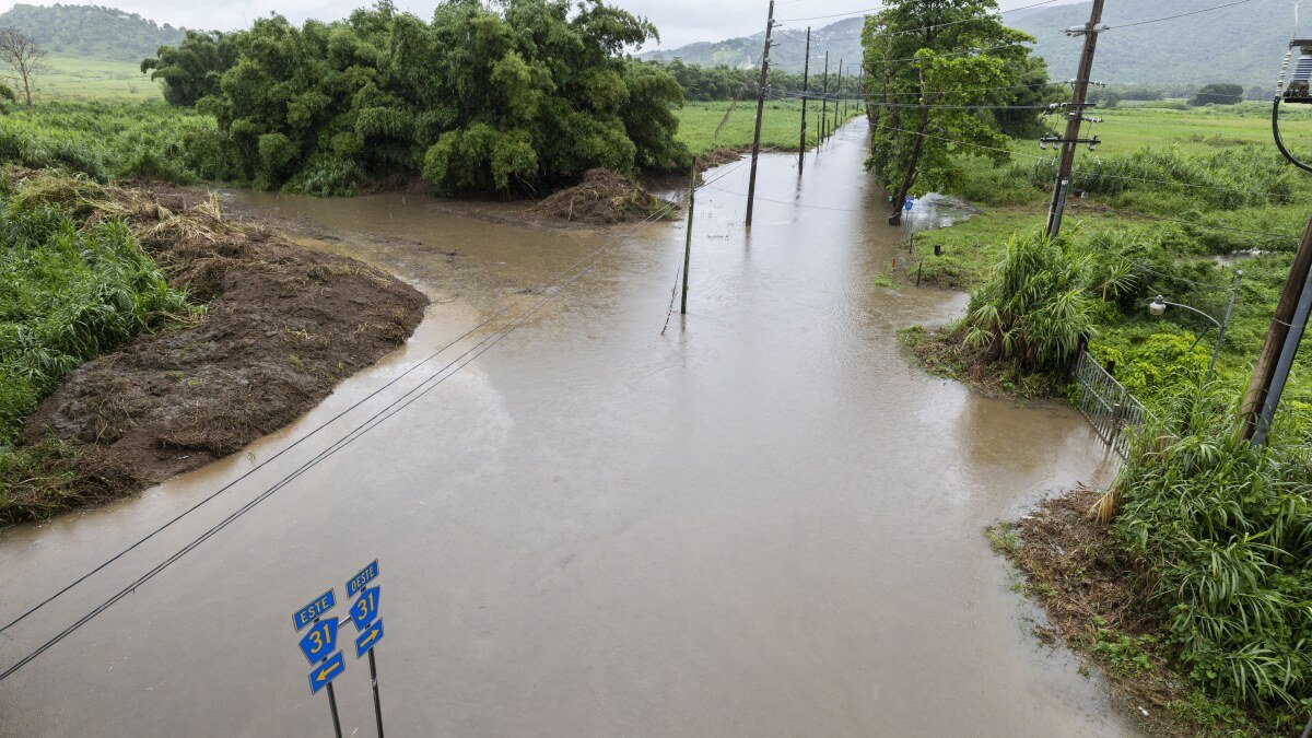
NC Highway 12 Expected to Flood
The sole route connecting a large portion of the Outer Banks, NC Highway 12, is expected to become unusable due to floods and sand overwash, the North Carolina Department of Transportation warned.
Heavy surf and 5- to 8-foot waves are predicted to be forced onto coastal highways by the storm, especially from Sunday night through Tuesday’s high tide cycles. Along NC 12, we expect several closures and perhaps significant damage, the agency stated.
Severe Coastal Impacts Anticipated
Although Hurricane Erin is not expected to directly hit in North Carolina, the National Hurricane Center stated that the storm’s outer bands will nevertheless cause numerous coastal dangers, such as:
-
Beach erosion and dune loss
-
Dangerous rip currents
-
Strong wind gusts exceeding 50 mph
-
Heavy rainfall and flash flooding in low-lying areas
Storm surges in some places, especially Ocracoke and Hatteras, can be more than three feet, which might cause property damage and saltwater infiltration.
Emergency Officials Urge Preparedness
In order to deploy emergency resources, activate shelters, and keep an eye on vulnerable people, North Carolina Emergency Management (NCEM) is working in tandem with local governments. In interior counties, the American Red Cross also keeps supplies on hand.
Travelers are being advised to postpone their plans to visit the Outer Banks until after the storm has passed and infrastructure evaluations have been finished. Numerous ferry routes have already been suspended, including those that go to and from Ocracoke Island.
NCEM Director Will Ray said, “We don’t want to see rescues in floodwaters or on the roads.” Storms like Dorian and Isaias have left us devastated, and this is expected to have comparable effects down the coast.
Wave and Surf Conditions Already Worsening
With wave heights approaching 10 feet off the Cape Hatteras National Seashore, surf conditions were already becoming worse as of Sunday morning. Red flags and no-entry warnings have been put at a number of well-known swimming beaches.
Numerous water rescues were reported on Saturday, and in the past 24 hours, ocean rescue workers have responded to dozens of calls. Until circumstances improve, officials are urging tourists to avoid beaches and the surf.
For ongoing updates on Hurricane Erin, information on emergency shelters, and road closures around eastern North Carolina, visit SaludaStandard-Sentinel.com.


