GREENVILLE, SOUTH CAROLINA — Hurricane Erin has returned to Category 4, and experts warn that even if it remains offshore, it may bring severe surf, rip currents, and floods to areas of the East Coast next week.
Storm Regains Intensity
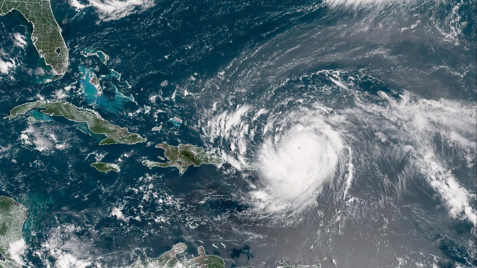
After briefly peaking as a Category 5 storm earlier in the weekend, meteorologists reported Erin had sustained winds of 140 miles per hour late Saturday, firmly placing it in Category 4.
Given how swiftly Erin developed from a tropical storm to a strong hurricane in just one day, experts characterized its rapid intensification as quite rare for this time of year.
Potential Impact on East Coast
Erin’s hurricane-force winds are compact and hazardous, even though they are just approximately 30 miles from the center. Strong rip currents, coastal flooding, and beach erosion may be caused by its extensive circulation throughout the Carolinas and farther north.
Depending on Erin’s ultimate path, forecasters warn that exposed regions like Cape Cod in Massachusetts, Long Island in New York, and North Carolina’s Outer Banks have a greater likelihood of tropical storm or hurricane conditions.
A Rare Early-Season Hurricane
Only a few storms in recorded history have intensified to Category 5 status before to mid-August, according to meteorologists. Erin joined a select few storms that have experienced such rapid growth, becoming the first hurricane of the 2025 Atlantic season.
Hurricanes Wilma in 2005 and Felix in 2007 are examples of similar events that experienced fast intensification in less than a day before making landfall.
Preparedness Urged Along Coast
Residents and beachgoers throughout the U.S. East Coast are advised to exercise caution this week, according to authorities. Erin could produce even in the absence of a direct landfall:
-
Hazardous rip currents starting early in the week
-
High surf and strong waves
-
Bands of rain and gusty winds reaching the coast
WYFF 4 News has the most recent prediction details.
As circumstances change and hurricane season heats up, keep an eye on the weather. FollowSaludaStandard-Sentinel.com for ongoing coverage of public safety news and tropical systems.


