
Hurricane Erin, a Category 3 hurricane with gusts of 110 mph, is now moving off the east coast. Tropical storm conditions are being brought to the outer banks by the storm, which is still well offshore, and will persist until Thursday. With a Tropical Storm Watch in place for Bermuda and Tropical Storm Warnings in effect for the Outer Banks, the storm has grown to an astounding 900 miles in width.
Large waves and highly rough surf will continue to be the greatest risks to these places. Mandatory evacuations have been implemented in Hatteras, Rodanthe, and Nags Head, among other parts of the Outer Banks. It is anticipated that many areas of NC 12 would be washed out and impassable for a number of days. As the storm moves offshore, severe beach erosion and structural damage are anticipated to occur. Waves between 10 and 20 feet are typical, with a maximum of 25 feet. A 2-4 foot storm surge is also probable. Wednesday evening and Thursday will be the hardest. Throughout the weekend, the eastern seaboard is likely to experience rough surf and rip currents.
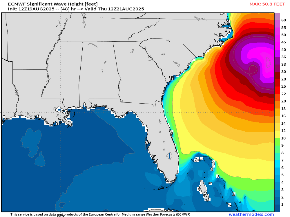
Due to the big waves and heavy surf, damage is still occurring on the outer banks.On Wednesday night, NC12 was closed, and it’s unlikely that some areas will reopen until the following week.
As Hurricane Erin moves closer to the East Coast, it gains momentum.


