Norfolk, Virginia.As powerful gusts and high waves lash the eastern Virginia coast, officials have issued a tropical storm warning, warning of potentially fatal maritime conditions through Thursday night. The National Weather Service Wakefield office reports that offshore seas are developing to almost 18 feet and that winds from the north to northeast are reaching 30 to 35 knots with gusts as high as 45 knots.
Chesapeake Bay and Inland Waters
The storm’s force is even being felt in protected waterways. Five to eight-foot waves are being produced by winds gusting between 25 and 30 mph inside the Chesapeake Bay. Additionally, gusts of up to 40 knots are whipping the lower James River and Currituck Sound, creating waves that range from two to five feet. Even experienced sailors are deterred from going out by these circumstances, and the Coast Guard has reiterated its advice to remain anchored until the weather clears up.
Marine Travel Nearly Impossible
Strong winds, poor visibility, and towering waves increase the risk of capsizing and serious vessel damage, officials warn, making marine transport all but impossible. Emergency advisories have been issued by the U.S. Coast Guard, advising all vessels from Virginia Beach to Chincoteague to stay safely anchored in port.
One Coast Guard representative stated that it is unsafe to navigate this water. Even larger vessels are at serious risk in seas as high as eighteen feet.
Coastal Communities Brace
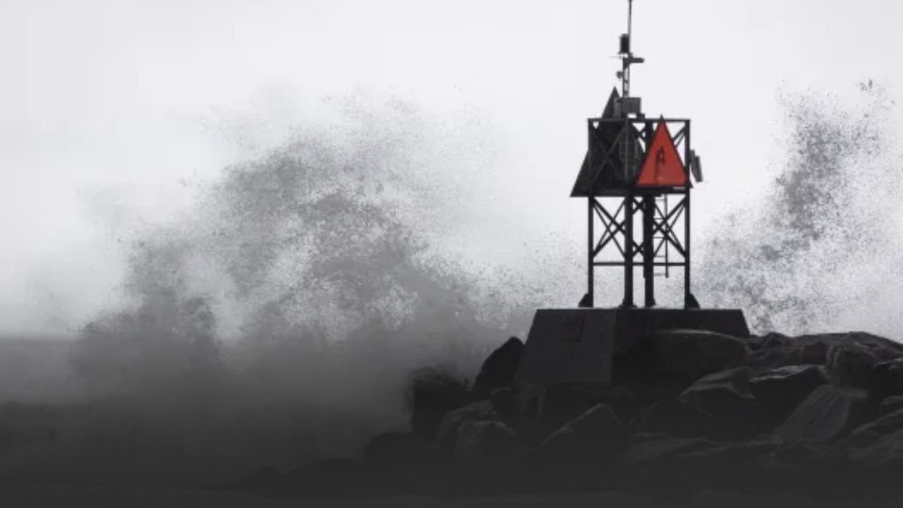
The storm’s effects are being felt on land from Virginia Beach to Chincoteague Island. Lifeguards are constantly on high alert due to rough surf, dangerous rip currents, and the possibility of beach erosion. As strong onshore winds continue throughout Thursday evening, local officials have also issued warnings to residents about the possibility of flooding along low-lying shorelines.
Crews are ready to respond to downed power lines, street flooding, and blocked roads as emergency management in Norfolk and Virginia Beach get ready for localized effects.
Forecast and Timeline
-
Thursday Morning Evening:
Winds remain strong (30 45 knots), seas up to 18 feet offshore, 5 8 feet in the Chesapeake Bay. -
Thursday Night:
Conditions gradually ease as winds shift, though seas remain elevated. -
Friday Morning:
Winds taper below 25 knots, seas fall closer to 10 feet offshore. -
Weekend Outlook:
Coastal Virginia may continue to see
rough surf and rip currents
through Saturday, even as weather calms.
Historical Context
Late-summer tropical storms are nothing new to Virginia’s coastline. The storm’s continuous winds and storm swave height are comparable to some of the most hazardous tropical storms in recent memory, while not being a hurricane-strength system. Significant delays are being reported by shipping businesses and fishermen in the Chesapeake region, and the economic effects are predicted to last throughout the weekend.
Safety Guidance
Authorities highly advise:
-
Mariners:
Remain docked and secure all vessels. -
Residents:
Stay alert for
flooding in low-lying areas
. -
Beachgoers:
Avoid entering the water due to life-threatening rip currents. -
Travelers:
Expect ferry service disruptions and potential delays at coastal airports.
Until further notice, the tropical storm warning will be in force. As conditions improve, updates are anticipated late Thursday. Officials stress that severe surf and rip currents will persist over the weekend, posing a threat to swimmers and small craft, even if winds are expected to lessen overnight.
Are you witnessing the effects of the storm in Virginia Beach, Norfolk, or Chincoteague? Post your pictures and updates in the SaludaStandard-Sentinel.com comments section.


