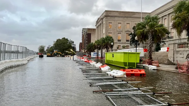
WILMINGTON, N.C. — Since high tide near the Cape Fear River is predicted to cause moderate roadway flooding and possible travel delays along USS North Carolina Road and neighboring neighborhoods, a coastal flood advisory is in effect for downtown Wilmington this afternoon.
Flood Risk From 2 to 5 p.m. Along the Riverfront
Wilmington’s National Weather Service warns that floodwater may back up through storm drains onto low-lying areas, especially around Market areas south of downtown. Authorities caution that during high tide, places along the shore may accumulate up to six inches of water above ground level.
Water may momentarily render certain roads impassable during the most affected timeframe, which is anticipated to be between 2 and 5 p.m.
Travel Advisory and Preparedness Tips
Drivers are advised to:
-
Avoid driving through flooded roads
, especially where water depth is uncertain -
Allow
extra travel time
for detours -
Move parked cars to higher ground
-
Secure outdoor furniture or objects
that could shift during storms or flooding
With the likelihood of thunderstorms returning on Friday night and Saturday afternoon, officials also warn that repeat flooding could occur during Saturday’s high tide cycle.
Wilmington Weather Outlook
-
Saturday:
Slight chance of storms after 2 p.m., high near 88 F -
Sunday:
Sunny, high near 89 F -
Monday:
Sunny, high near 89 F -
Tuesday:
Chance of showers and storms, high near 87 F -
Wednesday:
Mostly sunny, high near 87 F
NWS meteorologists said more alerts may be issued through Monday if tides stay high during the weekend.
Do you commute along Water Street or reside close to the Cape Fear River? If flooding has impacted your trip, please let us know. For information on the coastal weather threats in North Carolina, follow the Saluda Standard-Sentinel.


